
Building photogrammetry · Melbourne based

Building capture for inspection, drawing and measurement.

High-resolution roof and facade imagery, scaled orthophotos and 3D models for architects, consultants, building owners and survey teams.

01 Roof and facade inspection

02 Orthophotos for CAD

03 Complete building models

Building documentation

Aerial and ground capture for inspection and documentation.

Roofs and upper facades can be photographed by drone without first arranging scaffolding, temporary work platforms or an elevated work platform for visual access. General photographs can be supplied for inspection and reporting. The main photogrammetry service uses overlapping aerial and ground imagery to produce orthophotos, point clouds and textured 3D models. With suitable capture geometry and project control, these outputs can provide highly accurate measurements for CAD drafting, condition mapping and ongoing building records.

The capture method is planned around the area to be covered, the required measurement accuracy, the available control and the software used by the project team.

Example outputs

Orthophotos, measured models and 3D records.

Photogrammetry can produce a simple visual record or a controlled spatial dataset. The output is agreed before capture.

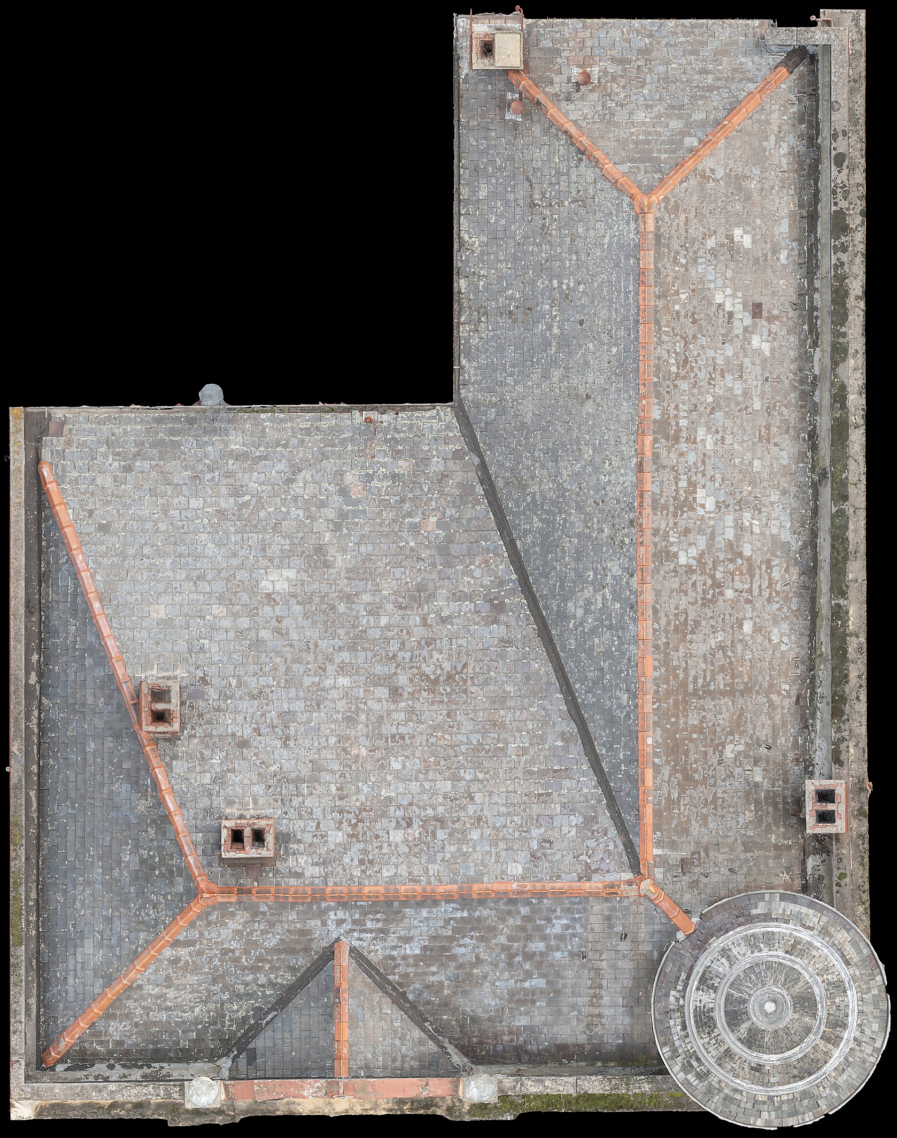
Photogrammetric roof orthophoto showing slate surfaces, ridges, gutters and a circular roof feature
Roof orthophoto Plan-view image output
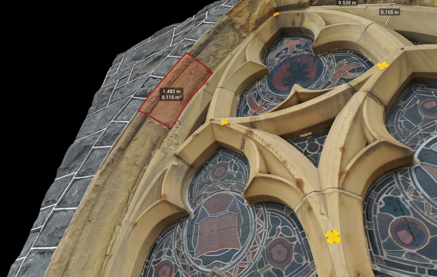
Local 3D model of a church window with dimensions and a measured area marked on the stonework
Measured facade detail 3D model markup
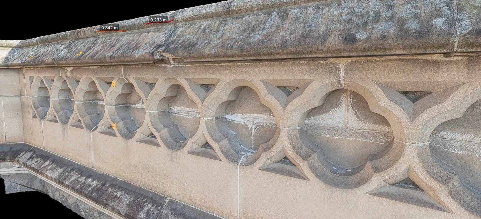
Local photogrammetric model of carved stonework with measured dimensions
Local model Detail measurement
Orthophotos
Scale-corrected 2D images for drawing, markup and measurement when suitable project control is established.
Point clouds
Three-dimensional spatial data for CAD, modelling and comparison with other survey or design information.
Textured models
Complete visual and geometric records ranging from individual details to large, multi-elevation buildings.

Services

Building inspection and photogrammetry services.

01

Visual inspection

Roof and facade imagery

Broad and close-detail photography of roofs, gutters, parapets, towers, facades and external plant. For an initial visual inspection, drone capture can often provide the required coverage without arranging scaffolding or an elevated work platform for photography alone.

  • Overview and close-detail image sets
  • Images grouped by roof area or elevation
  • Optional annotated contact sheets
02

Architectural documentation

Orthophotos for CAD

A scaled facade or roof orthophoto can be imported into AutoCAD, Rhino or similar CAD software as a raster reference for elevation drawings, dimension checks, repair markups and scope plans.

  • Facade and roof orthophotos
  • Scale and control stated at delivery
  • Image files prepared for CAD workflows
03

Spatial record

Whole-building 3D modelling

Drone and ground imagery can be combined to model complete buildings of considerable size, including roofs, towers and multiple elevations. Larger subjects are divided into planned capture areas and combined during processing.

  • Textured 3D meshes
  • Point clouds and model exports
  • Local detail and whole-building coverage
04

Controlled capture

Survey and design support

Target coordination, repeatable imagery and photogrammetric data can support survey, design and monitoring work. Where certified coordinates, boundaries or survey dimensions are required, the capture is undertaken under or alongside a licensed surveyor.

  • Ground-control and target support
  • Repeat capture from agreed positions
  • Data prepared for the project workflow

Additional capture

Aerial photography, progress records and promotion

The same site visit can also provide stills, short video and model views for reports, construction records or approved promotional use.

Method

Project workflow.

  1. 01

    Scope

    Confirm the site, required coverage, access, level of control and final file format.

  2. 02

    Capture

    Collect overlapping aerial and ground imagery around the geometry, light and site constraints.

  3. 03

    Process

    Align and check the images, apply the agreed control and produce the required 2D or 3D output.

  4. 04

    Deliver

    Supply clearly named files with the project scale, coordinate basis and relevant limitations stated.

Heritage building documentation

Collaborative delivery

Heritage work

Heritage projects follow the current collaborative pathway.

Photogrammetric capture can support condition records, measured drawings, repair planning and ongoing building documentation.

Where conservation or trade judgement is required, the work is coordinated with the relevant specialists. Heritage enquiries are reviewed against the approved delivery arrangement before a project is accepted.

Building Reality 3D

Building documentation from capture to delivery.

Building Reality 3D provides drone and ground photography, photogrammetric processing and spatial outputs for existing buildings.

Projects are planned around the required coverage, accuracy and final software, with capture and processing handled as one workflow.

If a project requires another discipline, including engineering diagnosis, specialist access, conservation advice or licensed survey work, that requirement is identified before the scope is accepted.

Project enquiries

What happens next.

A short outline of the building, the areas you need covered and the required output is enough for a first enquiry. I can then confirm whether photogrammetry is suitable and what further information may be needed.

arlo@buildingreality3d.com.au
Melbourne based · Projects across Victoria and beyond by arrangement